
Anatomy of the Scanifly Platform
Quality-obsessed solar companies use Scanifly to sell and design PV systems that always fit on install day.
Proposal-ready designs to jumpstart the sales process
Easily create PV layouts using satellite or Nearmap imagery and LiDAR-enabled shading to calculate production.
- Built for sales reps. A simple design environment your team actually enjoys using.
- Embedded inside Enerflo. A seamless design and proposal experience in one place.
- Unlimited designs per address. Iterate as much as you need without paying more.
Final designs accurate enough to kill change orders
DroneDesign™ turns your drone images into a photorealistic 3D model of the home and surrounding trees. What you design is what you install.
- Inch-level accuracy. True up initial designs with a to-scale 3D model.
- Be precise, not shady. Proprietary Viewsheds calculate real-time, onsite shading analysis without getting on the roof.
- Flawless engineering. Automatically export designs to CAD or your preferred racking partners.
A complete site survey with just a drone and your phone
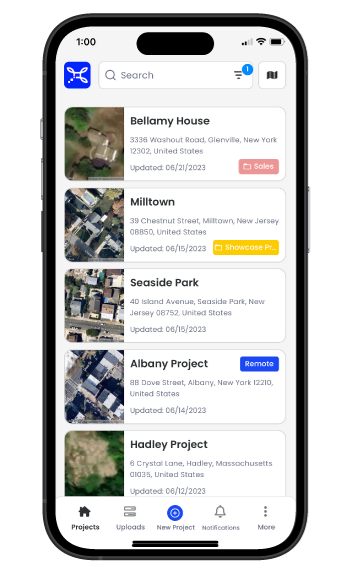
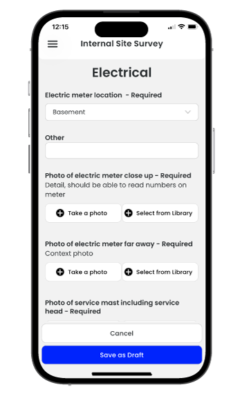
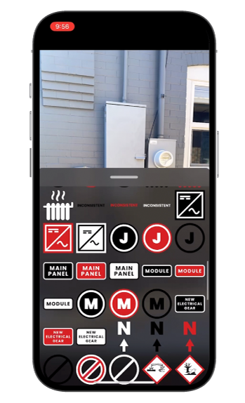
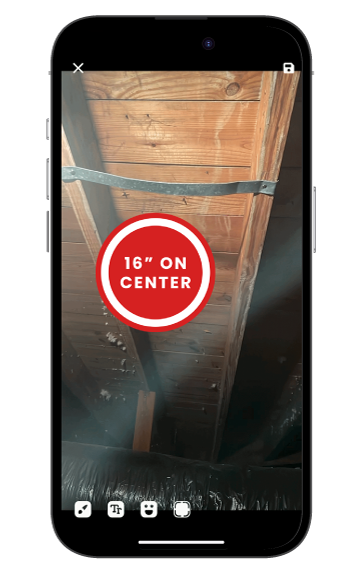
Our free mobile app digitizes your site survey, installation, and maintenance processes, so you never miss a detail and get to PTO faster than ever before.
- 90% less time onsite. A 5-minute drone flight replaces roof climbs and manual hand measurements.
- Ditch the pen and paper. Easily capture all structural, electrical, and property information with digital checklists.
- Upload from the field. Submit checklists and drone images directly in the app, giving your designers everything they need while you head to the next site visit.
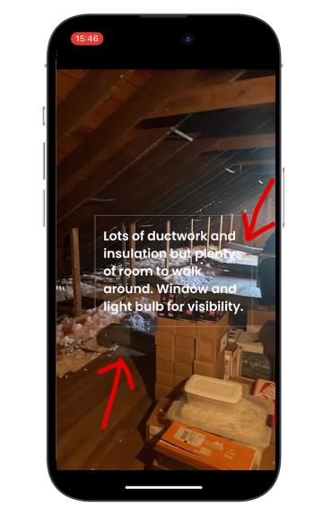
Offload design work at any stage of the project
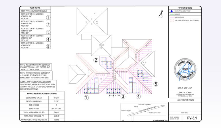
Let our solar design experts create customizable AHJ-ready plan sets and stamps in under 48 hours, from within your Scanifly account.
- Designs for the sale. For jobs you haven't flown yet, our team builds a design that gives your sales reps what they need to run a great first appointment.
- Designs after the flight. Just upload your drone images and our team delivers the 3D model with all roof surfaces and obstructions outlined. You just place the panels.
- Plan sets and stamps. Fully customizable, AHJ-ready plan sets and engineering stamps built from your 3D model and onsite data.
“Software is very intuitive and user friendly, and the Scanifly team is super responsive and helpful. Extremely open to feedback.”
“Awesome product and company. Continually improving and they respond quickly to suggestions and issues. Has transformed our preliminary designs.”
“I work more efficiently and safer now that I can use a drone for my site visit. There are a lot of jobs I would not have been able to survey without a drone.”
“Scanifly has been game-changing for our process and projects. The tech and the support team have made life easier and our final product better.”
“As a NABCEP Certified Technical Sales Professional, Scanifly helps me to deliver a better experience to my clients.”
“More accurate designs, less field changes, and faster on-site assessments.”
“Cleaner designs based on real data. Customers like seeing the drone and I like providing snapshots of their house from the 3D model.”
“More sales, faster and more accurate surveys. Better designs with no installation busts.”
Inaccurate design data falls apart in the field
You're tired of outdated remote imagery, manual site surveys, or creating final designs with poor data. Or worse, it's all the above.
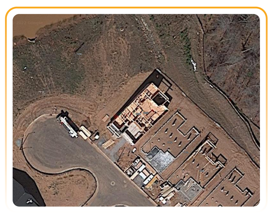
Overpriced and inaccurate remote design tools cause change orders on install day and delay commissions.
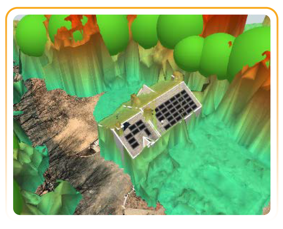
Outdated LiDAR and guessing tree heights overpromises production and shading, leading to financing rejections.
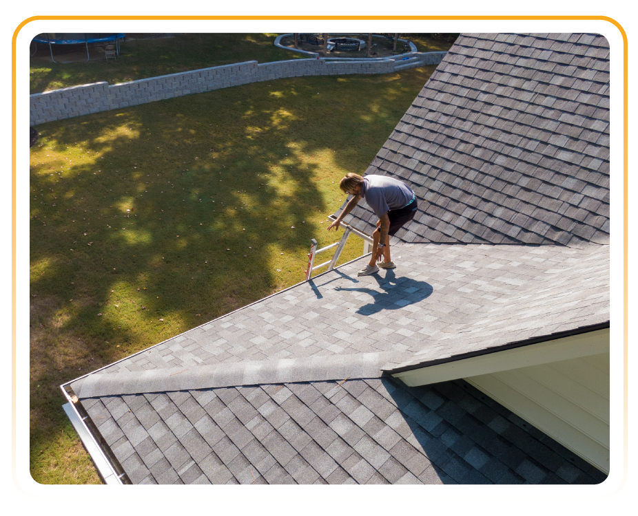
Climbing on the roof is dangerous and inefficient, resulting in missed data and extra truck rolls.
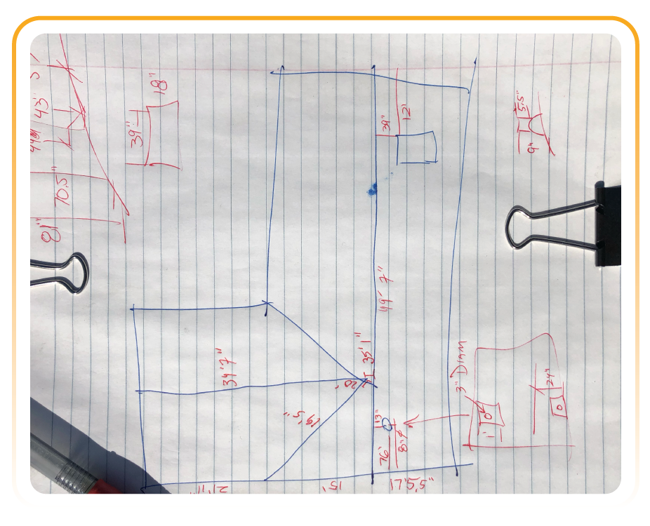
Translating hand-written notes to CAD causes revisions, re-permitting, and as-builts.

One design platform for every stage of the project
Because sales and ops shouldn't design in different software.
Remote Design
PrelimDesign™ builds proposal-ready estimates from satellite or Nearmap imagery and LiDAR.
Site Survey
A 5-minute drone flight and digital checklists replace roof climbs, tape measures, and pen & paper.
Onsite Design
DroneDesign™ delivers exact module fitment and real-time onsite shading.
Plan Sets
Export to CAD or racking providers, and order on-demand stamped plan sets.
Install & Commissioning
Photo checklists upload to finance providers for faster approvals.
Built for sales and operations teams that care about quality
Real results from solar contractors running on Scanifly.

Frequently asked questions
The most common questions about designing and surveying with Scanifly.
Who flies the drone?
What drones work with Scanifly?
Does Scanifly sell drones?
What if I don't have a drone?
How accurate is DroneDesign™?
How accurate is PrelimDesign™?
What is the difference between PrelimDesign™ and DroneDesign™?
Who has approved Scanifly's shading analysis?
See the whole platform in action
Walk through PrelimDesign™, DroneDesign™, Scanifly Mobile, and Design Services with our team.
Book a DemoScanifly vs Aurora Solar
When and why to recommend Scanifly to an Enerflo customer using Aurora.
Is this customer a Scanifly fit?
Great signs your customer is ready to switch.
Overpaying for Aurora
Aurora pricing is opaque and expensive. Scanifly typically costs 50%+ less with transparent flat pricing.
Tech stack is bloated
Running Aurora + Enerflo + CompanyCam or SiteCapture + CAD? Scanifly + Enerflo consolidates it all into two tools.
Post-sale surprises
Panel fitment issues, installation delays, or change orders? Drone-based data eliminates redesigns.
Redesigns & change orders
Satellite imagery causes ~90% of contractors to redo work. Scanifly drone design eliminates this entirely.
Roof surveys slow them down
Surveyors still climbing roofs? Scanifly + drone = 10-min survey, no roof climbs, faster permitting.
Aurora feels transactional
No feedback loop, support only at renewal, rigid proposals. Scanifly is built by solar professionals.
Two different bets on solar software
Design, Field Ops, Sales.
Built for the full project lifecycle — from remote design to drone survey and final design. Drone-based accuracy eliminates redesigns. Complements Enerflo with zero overlap.
Sales tool first. Design second.
Built for closing deals from satellite data. No field ops. Proposals and financing duplicate what Enerflo already does — creating stack overlap, not simplification.
Pick the right tool for the customer
- ✓Customer is on Enerflo — Scanifly is the #1 ranked integration
- ✓Paying for Aurora + Enerflo + CompanyCam + SiteCapture
- ✓Design accuracy, zero redesigns, or permit quality is a priority
- ✓Post-sale fitment issues, change orders, or installation delays
- ✓Team does on-site surveys — drone saves time and eliminates roof climbs
- ✓Frustrated with Aurora pricing, support, or proposal rigidity
- →100% remote sales workflow, zero site visits planned
- →Deep electrical/battery modeling is a day-one need
- →Not on Enerflo — needs proposals & financing in one tool
- →Enterprise SSO, multi-team or partner account management
- →Note: Aurora’s proposals & CRM features are a long-term Enerflo risk
Teams that have made the switch
Scanifly vs Aurora, line by line
| Feature | Scanifly | Aurora |
|---|---|---|
| Remote Design & 3D Modeling | ||
| AI-powered roof modeling from satellite/aerial imageryParity | ✓ | ✓ |
| LiDAR reference layerParity | ✓ | ✓ |
| Nearmap HD aerial imageryParity | ✓ | ✓ |
| 3D model accuracy — drone data within 2–3″Scanifly advantage · Aurora satellite-based | ✓ | ~ |
| Design versioning (sync multiple versions)Scanifly advantage | ✓ | — |
| Ground mount supportScanifly advantage | ✓ | — |
| Shading & Production | ||
| LiDAR-based shading analysisParity | ✓ | ✓ |
| On-site shading — SunEye-equivalent accuracy from drone dataScanifly advantage | ✓ | — |
| 3D viewshed & auto-refreshing shade calculationsScanifly advantage | ✓ | — |
| Bankable shade reports — accepted by all major lendersParity | ✓ | ✓ |
| Production simulation (PVWatts)Parity | ✓ | ✓ |
| Sales, Proposals & Financing | ||
| Interactive proposals, PDF proposals & e-signatureAurora advantage · Enerflo covers this | ✓ | ✓ |
| Embedded financing (GoodLeap, Mosaic, etc.)Aurora advantage · Enerflo covers this | — | ✓ |
| Energy Toolbase integration for storage modelingScanifly advantage | ✓ | — |
| Enerflo integration rank#1 Scanifly vs #3 Aurora | ✓ | ~ |
| Array Design & Layout | ||
| Automated & manual array placementParity | ✓ | ✓ |
| Obstruction & setback toolsParity | ✓ | ✓ |
| Tree modeling & occluder toolsScanifly advantage | ✓ | ~ |
| Electrical modeling — inverter calcs, stringing, SLD auto-genAurora advantage | — | ✓ |
| Battery & storage modeling (NEM 3.0, arbitrage, backup)Aurora advantage | — | ✓ |
| Field Operations | ||
| Mobile app — surveys, drone upload, markups, checklistsScanifly advantage | ✓ | — |
| Drone-based site survey (~10 min, eliminates roof climbs)Scanifly advantage | ✓ | — |
| Custom checklist builder with conditional logicScanifly advantage | ✓ | — |
| Outputs & Exports | ||
| DXF CAD export (ortho-rectified)Parity | ✓ | ✓ |
| 3D wireframe export & 3D animationScanifly advantage | ✓ | — |
| Plan set generation & design serviceParity | ✓ | ✓ |
Who you’re actually working with
Scanifly — partner mentality
- ✓US-based support 9am–9pm, staffed by former solar professionals
- ✓Typically 50%+ less than Aurora; transparent flat pricing
- ✓Customer Advisory Board; feedback drives the roadmap
- ✓NABCEP-approved training & Scanifly Academy
- ✓Open integrations — any proposal tool, your workflow
Aurora — vendor, not a partner
- ×Support shows up at renewal; hard to reach in between
- ×Opaque per-credit billing — $20/proposal, $40–50 with AI
- ×Recent changes degraded the product; requests rarely addressed
- ×No belief in on-site data — satellite imagery is “good enough”
- ×Walled garden — proposals & financing locked inside Aurora
Win the Enerflo customer
Scanifly is the #1 ranked Enerflo integration. Walk a prospect through the full platform with our team.
Book a DemoScanifly vs Aerialytic
When and why to recommend Scanifly to an Enerflo customer using Aerialytic.
Is this customer a Scanifly fit?
Great signs your customer is ready to switch.
Using Aerialytic + another tool
Running Aerialytic + Aurora or another design tool? That’s two sales-only tools doing the same thing. One Scanifly subscription does more than both.
How are you submitting shading?
Aerialytic is not a bankable shading tool for many finance providers. Teams end up paying for a second shading tool. Scanifly shading is lender-approved out of the box.
Post-sale surprises
Panel fitment issues, installation delays, or change orders after signing? AI-only designs without onsite data cause ~50% fitment change rates.
Redesigns & change orders
AI-only designs without site validation cause redesigns. Scanifly DroneDesign gives inch-accurate measurements and real-time onsite shading, eliminating rework entirely.
Site surveys done manually
Team capturing site data by hand or phone? Scanifly + drone makes surveys faster, safer, and more accurate in ~10 minutes.
Want to stand out from the competition
Aerialytic gives every contractor the same AI output. Scanifly gives you drone-accurate models your competitors cannot match.
A full platform vs. a single feature
Design, Field Ops, Sales.
Built for the full project lifecycle — from remote design to drone survey and final design. Drone-based accuracy eliminates redesigns. Complements Enerflo with zero overlap.
AI remote design. That’s it.
AI-generated designs on Nearmap data with minimal editing ability. No field ops, no proposals, no shading accuracy, no plan sets. Struggles in complex or rural areas. Known to produce ~50% fitment change rates in production.
Pick the right tool for the customer
- ✓Customer is on Enerflo — Scanifly is the #1 ranked Enerflo integration
- ✓Using Aerialytic + Aurora / another design tool
- ✓Design accuracy, zero redesigns, or permit quality is a priority
- ✓Post-sale fitment issues, change orders, or installation delays
- ✓Team does manual site surveys — drone makes them faster and safer
- ✓Want to differentiate from competitors all using the same AI output
- →Truly just need a quick AI design
- →Hates change and believes wholeheartedly in remote
- →No plans to ever go on-site or validate designs in the field
Scanifly vs Aerialytic, line by line
| Feature | Scanifly | Aerialytic |
|---|---|---|
| Remote Design & 3D Modeling | ||
| AI-powered roof modeling from satellite/aerial imageryParity | ✓ | ✓ |
| LiDAR reference layerScanifly advantage | ✓ | — |
| Nearmap HD aerial imageryParity | ✓ | ✓ |
| 3D model accuracy — drone data within 2–3″Scanifly advantage | ✓ | — |
| Design versioning (sync multiple versions)Parity | ✓ | ✓ |
| Ability to manually edit designsScanifly advantage · Aerialytic minimal editing only | ✓ | — |
| Ground mount supportScanifly advantage | ✓ | — |
| Shading & Production | ||
| LiDAR-based shading analysisScanifly advantage | ✓ | — |
| On-site shading — SunEye-equivalent accuracy from drone dataScanifly advantage | ✓ | — |
| Bankable shade reports — accepted by all major lendersScanifly advantage | ✓ | — |
| Sales, Proposals & Financing | ||
| Prelim / sales design toolParity | ✓ | ✓ |
| Interactive proposals, PDF proposals & e-signatureScanifly advantage · Enerflo covers this | ✓ | — |
| Embedded financing integrationsNeither · Enerflo covers this | — | — |
| Energy Toolbase integration for storage modelingScanifly advantage | ✓ | — |
| Array Design & Layout | ||
| Automated & manual array placementScanifly advantage · Aerialytic auto-only | ✓ | ~ |
| Obstruction & setback toolsScanifly advantage | ✓ | ~ |
| Tree modeling & occluder toolsScanifly advantage | ✓ | — |
| Electrical modeling — inverter calcs, stringing, SLD auto-genNeither | — | — |
| Battery & storage modelingNeither | — | — |
| Field Operations | ||
| Mobile app — surveys, drone upload, markups, checklistsScanifly advantage | ✓ | — |
| Drone-based site survey (~10 min, eliminates roof climbs)Scanifly advantage | ✓ | — |
| Custom checklist builder with conditional logicScanifly advantage | ✓ | — |
| Outputs & Exports | ||
| DXF CAD export (ortho-rectified)Scanifly advantage | ✓ | ~ |
| 3D wireframe export & 3D animationScanifly advantage | ✓ | — |
| Plan set generation & design serviceScanifly advantage | ✓ | — |
Who you’re actually working with
Scanifly — partner mentality
- ✓US-based support 9am–9pm, staffed by former solar professionals
- ✓Private Slack channel — direct access to in-house solar experts
- ✓Customer Advisory Board; feedback drives the roadmap
- ✓NABCEP-approved training & Scanifly Academy
- ✓Typically 50%+ less than Aurora; transparent flat pricing
- ✓Open integrations — any proposal tool, your workflow
Aerialytic — AI tool, minimal human support
- ×Minimal support infrastructure; limited responsiveness
- ×No known customer advisory or feedback program
- ×Product roadmap not influenced by customer input
- ×No solar-specific training or certification programs
- ×Pricing not publicly available; limited transparency
- ×Limited integration ecosystem beyond Enerflo connection
More than AI design
Scanifly gives Enerflo customers the full cycle — design, field ops, and final design accuracy Aerialytic can’t match.
Book a DemoReferral vs Reseller Partner Guide
Look for signal patterns, not perfect matches. These are archetypes to guide routing decisions.
- Mid-to-large EPCs; process-oriented smaller EPCs
- Aurora Solar, Solargraf, or Site Capture subscriber
- Not all-in on Aerialytic, wants a richer design workflow
- Digitized field ops (CompanyCam, mobile apps)
- Tracks revision rates and pull-through rates
- Has a design desk or QA guardrails on AI designs
- Internal + external reps; maintains design control
- Thinks about O&M, maintenance, long-term customers
- Values AI for speed, but requires true-up pre/post sale
- Has a defined string-up / QA process
- “Are you using Aurora Solar, Site Capture, or Solargraf?”
- “Do you track revision rates? What’s your post-sale workflow?”
- “Do you true up AI designs? When and how?”
- “Would drones be part of your ideal workflow?” → Yes
- Smaller groups or large dealer-heavy orgs
- Sales-first culture; minimal tech investment
- All-in on Aerialytic or AI-only remote design tools
- Simple, centralized stack built around sales tools
- Does not track revision rates or change orders
- Heavily subcontracts survey, design, permitting
- Asset-light, decentralized: “back end figures itself out”
- AI designs = the deal; speed over QA
- Decision driver: “what does the finance company approve”
- “Are you primarily using Aerialytic or remote AI imagery?”
- Probe post-sale workflow: vague or dismissive answers = signal
- “AI designs: QA process, or straight to finance approval?”
- “Would drones be part of your ideal workflow?” → No
Goal: Meet every contractor where they are in their tech stack. · Questions? Contact your Scanifly partner.
Client-Facing Onboarding Training
A four-week ramp, from first Scanifly demo to a confident design workflow.
Four weeks to design-ready
- Group Scanifly demo
- Design course (30 min) + SimpleDesign video
- Create Scanifly login
- 1:1 check-in with Scanifly onboarding (Daniel Castano)
- Practice the integration
- OptionalScanifly Academy full-length design course
- OptionalScanifly case studies + blogs
- Group reseller dashboard demo
- OptionalScanifly Academy Surveyor Associate prep
- 1:1 closeout with Scanifly onboarding (Daniel Castano)
- Conclude design abilities
Scanifly Design Tool FAQs
Imagery, AI design, shading, setbacks, AHJ, and the Enerflo integration, answered.
Where to get help
Support priority: use hello@scanifly.com for general questions. For technical or non-general questions, use the shared Slack channels. For urgent issues, tag Timothy Jackson and Sam Evans in Slack.
Imagery & Data Sources
What imagery sources are available in my area?
Scanifly pulls from several data sources depending on your location and plan.
Free sources (every account):
- Google Maps satellite imagery: base layer for all designs.
- Azure and Mapbox map tiles: alternative base layers.
- LiDAR (public dataset, ~2022 vintage): 124k points; provides tilt, height, and shading elevation data.
- Google 3D (G3D, ~2018 vintage): 900k points; photorealistic mesh used for fitting roof outlines and shading.
Premium add-ons:
- NearMap: high-resolution aerial imagery captured by airplane, significantly more current and detailed than free tiles. Optional paid add-on, especially valuable in dense urban or wooded areas.
- Drone-generated 3D model: an on-site drone flight processed into a proprietary high-resolution 3D model. The most accurate option available.
What is the difference between LiDAR, Google 3D, and NearMap?
- LiDAR: Open-source point-cloud data (~2022). Used to set roof tilt and height. Requires manual alignment but gives solid elevation data where available.
- Google 3D (G3D): Photorealistic mesh (~2018). Higher point density than LiDAR. Used with the Fit to Google 3D button to snap roof outlines to the correct height and pitch. Can also be enabled for viewshed shading analysis.
- NearMap: Plane-captured high-resolution imagery. More current than G3D and dramatically sharper, which improves layout accuracy. Particularly helpful in the Northeast, where tree cover and older imagery degrade remote design quality.
AI Design Tool & Accuracy
How does the AI design tool work?
When you open a remote design project in Scanifly (or inside Enerflo via the embedded window), click AI to generate a MaxFit layout automatically. The AI traces the roofline using available satellite imagery and data layers, places modules, and avoids keepout zones. You can then make manual adjustments.
What affects remote design accuracy?
Several factors can reduce remote design accuracy:
- Imagery age: G3D data is from ~2018; trees, additions, or obstructions added since then won’t appear.
- Tree cover: dense canopy in the Northeast and Canada makes it harder to distinguish roof edges and detect shading objects.
- Image resolution: free map tiles can be too blurry for large commercial rooftops. Use NearMap for those.
- Flat roofs: azimuth must be set manually before enabling the Manual Layout Editor; the editor locks azimuth once enabled.
Remote design accuracy is limited in heavily wooded or imagery-poor areas. In those cases, an on-site drone scan is the recommended path to a reliable design.
How accurate is a drone-based design vs. remote?
Drone-based designs are substantially more accurate. Remote designs can be upwards of 6 inches off, whereas drone-based designs are accurate within an inch.
Dimensional accuracy: with proper flight settings (45-degree obliques + exterior orbit, 2.5 mph or less, correct overlap), vertical features like HVAC units and parapets typically come in within 1 inch. Roof-to-roof linear dimensions are typically within ~1%.
Shading Analysis
How does Scanifly’s shading analysis work?
Scanifly uses a patented viewshed system that calculates shading at the individual module level. Production is calculated using PVWatts, applied to the 3D model (either remote or drone-based). The irradiance map (ASA/TSRF view) shows shade patterns visually across the array.
To generate a shade report: Exports > Shade Files > choose Short PDF.
Do you have Google 3D (G3D) shading?
Yes. Google 3D is available as a reference layer in all Scanifly accounts. To use it for shading:
- In the Layers panel, select the Google 3D layer.
- In Properties, enable Include in viewshed shading analysis.
- Important: the G3D layer must be positioned correctly (below the roof texture). If it sits on top of the roof surface it will cast a false blanket shadow over the entire array.
Should I use Google 3D or manual trees for shading?
- Google 3D: faster setup. Good for a quick shade estimate using existing mesh data. Best when the surrounding tree canopy in G3D matches current conditions.
- Manual trees: more control. Use the Trees tool (T key) to draw individual trees, then use Fit to Google 3D to set their height. Lets you simulate tree removal to show production gains. Better for sites where trees have grown or been removed since 2018.
Setbacks & Losses
How do I set fire setbacks?
Setbacks are a specific type of keepout. To add them:
- Select the roof plane.
- Enter Keepouts mode (keyboard shortcut: 2).
- Press S to activate the Setback tool, which automatically creates a buffer zone around the entire roof edge.
- Adjust the setback distance in the Properties panel.
For individual obstructions and fire pathways, use the box (B) or circle (C) tools in Keepouts mode. Assign a height to keepouts like HVAC units; this creates a shadow that feeds into the shade analysis.
How do I adjust production losses?
Loss adjustments are in the Simulation tab of the design editor. Scanifly supports granular monthly loss adjustments, useful for climates with seasonal snow cover, soiling variability, or other monthly factors. Adjust the DC:AC ratio and system efficiency settings here as well. Note: Scanifly does not model inverters directly, so inverter efficiency is entered as a flat percentage.
AHJ & Compliance
Does Scanifly have an AHJ database?
Scanifly does not have an AHJ database that automatically applies local code requirements inside the design editor. Setbacks and fire pathways in the design tool are either set by users with the built-in presets, or entered manually by designers based on their knowledge of local requirements.
There are two ways setbacks get applied:
- Automatic via presets: users can configure default setback values in account settings (e.g., 3 ft ridge, 18 in eave) so they apply automatically to each new design. See the Setbacks Settings article.
- Manual entry: designers can draw keepouts and setbacks by hand in the design editor to match specific AHJ requirements for a given project.
What about AHJ compliance when ordering a plan set?
The AHJ database does come into play when you order a full plan set through Scanifly’s Design Services team. In that workflow, the team maintains a national code database and applies the correct local requirements (setbacks, walkway widths, code version, etc.) when producing the plan set. If a plan set is kicked back due to an outdated code interpretation, Scanifly will revise it at no charge and update the database.
Outside of ordering a plan set, AHJ code compliance is the designer’s responsibility based on their knowledge of the local jurisdiction.
Enerflo Integration
How does the Enerflo + Scanifly integration work?
Scanifly is embedded directly inside the Enerflo platform. Reps can design and generate proposals without ever leaving Enerflo:
- Rep opens a lead or opportunity in Enerflo.
- Clicks into the embedded Scanifly window to design.
- Make sure the rep’s Enerflo account email matches their Scanifly account email exactly.
- Uses the AI tool for a MaxFit layout, or builds manually.
- Finalizes and saves the design, then hits the sync icon to send it to Enerflo for proposal generation.
- Multiple designs can be cloned to compare options (e.g., with and without battery).
- Multiple proposals can be created for different lenders or equipment configurations.
Can reps submit designs to a design team queue from Enerflo?
Yes. From within the Enerflo interface, reps can submit design requests to Enerflo’s internal design queue rather than self-designing. The assigned designer builds the design in Scanifly and the finalized version syncs back to Enerflo for proposal.
Does the mobile app integrate with Enerflo?
Yes. When a project is created in Enerflo, it auto-syncs to the Scanifly mobile app. The app surfaces the correct project based on the user’s location. Site photos taken in the app can be routed directly back to Enerflo, keeping reps in a single system. The mobile app also replaces CompanyCam for site survey checklists; these are fully customizable with required fields, example photos, and conditional logic.
Simple Design Mode
What is Simple Design Mode?
Simple Design Mode is Scanifly’s streamlined design interface built for the sales process. Instead of the full design editor with all its tools and layers, Simple Mode presents a clean, step-by-step workflow reps can complete quickly at the kitchen table or during a site visit. It is optimized for speed and ease of use rather than detailed customization.
Important: the Enerflo integration runs exclusively in Simple Design Mode. When a rep designs inside the embedded Scanifly window within Enerflo, they are using Simple Mode. The full Scanifly design editor is not accessible through Enerflo.
How does Simple Design Mode work?
Simple Mode walks through four steps:
- Step 1, Consumption data: kWh usage data is ported in automatically from Enerflo, or can be entered manually.
- Step 2, Module selection: all roof planes capable of holding panels appear with grid-like modules. Tap or drag across modules to toggle them on/off. Enable the irradiance map to identify the highest-production areas and build the optimal layout.
- Step 3, Review system output: a per-segment breakdown including module count, array size, TSRF, tilt, and azimuth for each roof plane.
- Step 4, Finalize: selecting Finalize or the Save icon saves the design and lets Enerflo sync the data back to their platform.
What can Simple Mode do vs. the full editor?
- Simple Mode: designed for sales reps. Fast, tap-to-place module layout, consumption-offset targeting, irradiance map, per-segment output summary, and automatic CRM/proposal sync. No manual roof tracing or layer management required.
- Full editor: designed for design teams. Manual roof outlining, keepouts, tree modeling, shading analysis, loss settings, CAD exports, and all advanced tools. Not available through the Enerflo integration.
If a more detailed design is needed after the Simple Mode sales design (for example, for plan sets or engineering), a designer can work in the full Scanifly editor separately and sync the result back to Enerflo.